
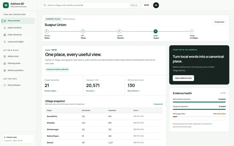
The visible feature was only the surface
Bangladesh location records are spread across differently structured sources, making normalized lookup, provenance review, and repeatable machine consumption difficult.
The system also had to respect concrete constraints. Administrative boundaries, names, and facilities change. Source coverage and confidence vary and do not establish authoritative identity/address truth. Health, emergency, eligibility, routing, or legal use requires current authoritative confirmation.
My role covered data modeling, validation, and release engineering, with responsibility for provenance, transformation, validation, and distribution.
I turned the constraints into boundaries
Source/provenance manifests; normalized records governed by JSON Schema; JavaScript validation/build scripts; versioned JSON, JSONL, compressed, and SQLite release outputs with samples/docs.
Preserve source lineage and limitations beside normalized data instead of hiding uncertainty.
Commit schemas/manifests and generate distribution formats, trading release work for reviewability.
Publish multiple interoperable formats from one model rather than maintain divergent datasets.
The key decision: Preserve source lineage and limitations beside normalized data.
The implementation had to prove the model
I delivered the work across the full path: Designed normalized geographic/facility schemas. Assembled provenance and coverage manifests. Built validation and deterministic release-generation scripts. Documented responsible use, update process, samples, citation, and source terms.
The result is concrete: Consumers can download structured location data. Validate records against schemas. Choose JSON, streaming JSONL, or SQLite. Trace coverage and provenance limitations before use.
The senior engineering lesson was that solving the visible workflow is only half the job. The architecture must also make constraints, failure modes, evidence, and ownership explicit enough for the next change to remain safe.